Kailua Waterways

  • History
  • Brown Water
  • Water Quality
    • Water Quality Overview
    • Does Kaelepulu Stream Pollute Kailua Bay?
    • Fish Habitat
    • Kaelepulu Pond Drainage Agreement
    • Major Storm Drain Outlets to Kaelepulu
    • Detailed Kaelepulu watershed map
    • Kailua Waterway Owners
  • Problems & Solutions
    • Problems & Solutions
    • What you can do
    • Opening the Stream Mouth – Berm
    • Sign the petition to open the berm
  • Reports
    • Natural History, Hydrology and Water Quality of Enchanted Lake – Kaelepulu Pond
    • 2025 Proposed Stormwater Projects
    • TMDL Kaelepulu Update 2023
    • Ka’elepulu Assessment Report 2021
    • TMDL Reports
    • Kawai Nui Flow Restoration Experiment Final Report
    • Investigating an Impaired Waterway
    • 2008 City BMP Plan
  • Resources
  • Search

Kaelepulu watershed storm drain map

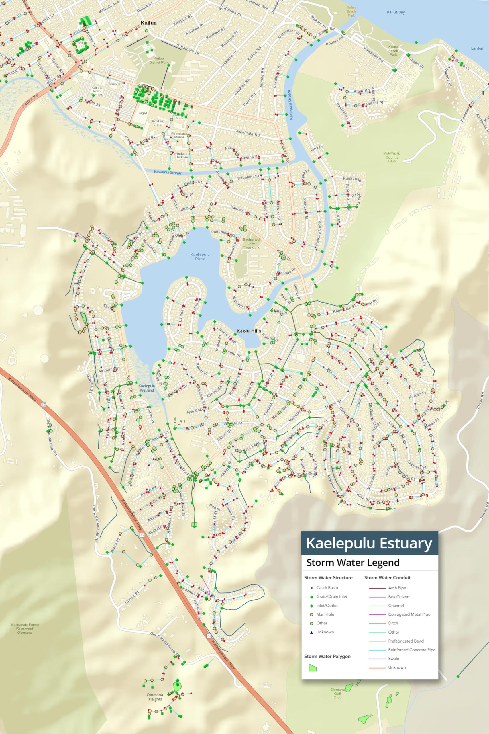
This detailed map shows all the storm water conduits and stormwater drains that empty into the Kaelepulu Estuary. This map includes areas west of Kalanianaole Highway that are often the source of significant sediment from stormwater due to the heavier rainfall and large areas of bare dirt from construction sites, and wide bare trails in the mountains. Click to view a larger version of the map.

Kaelepulu watershed Storm Drain Map

Copyright © 2025 | Contact the webmaster